If you live in Dallas, there’s a good chance you’ve received a letter from the city about your home’s water service line. The notice asks homeowners to check what kind of pipe connects their house to the water meter and upload photos to an online form. At first glance, it may seem like a small, one-time request. But if you think about it, it touches something bigger—how much you really know about what’s buried on your property. That’s where an ALTA survey can make all the difference.
Dallas Water Utilities is sending out more than 225,000 of these notices as part of a national effort to identify old lead service lines. It’s tied to new federal rules under the Environmental Protection Agency’s Lead and Copper Rule. Every city must confirm the material used in every water line by a set deadline, and any lead or unknown connections must be replaced within ten years. That’s a big job for both the city and property owners.
The City’s Request: A Simple Photo, a Serious Purpose
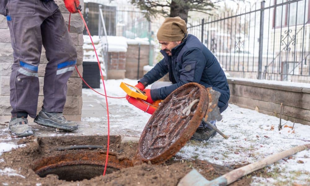
The city’s online form asks homeowners to take two photos—one where the pipe enters the home, and another near the water meter box. Dallas also provides a short guide to help residents tell the difference between copper, plastic, galvanized steel, or lead. If the material can’t be identified from the photos, city inspectors may need to follow up in person.
For many people, this might be the first time they’ve thought about what’s under their lawn or slab. It’s not something most homeowners ever check. But the truth is, that small stretch of pipe is your responsibility. If it’s lead or if its condition is unknown, the cost to replace or verify it could eventually fall on you.
Why an ALTA Survey Matters Right Now
An ALTA survey—short for American Land Title Association survey—isn’t just for commercial properties or large developments. It’s the most complete type of land survey, mapping everything from boundary lines and easements to improvements and utilities.
For homeowners, one of the most overlooked parts of an ALTA survey is Table A, Item 11, which covers underground utilities. It shows where private water, sewer, and electrical lines are located on the property. Having that information now can save major headaches later.
Let’s say your ALTA survey is current. You already know where your water line runs, how deep it goes, and where it connects to the main. That means when you take the city’s requested photos, you can match them to a mapped location. You’re not guessing where the pipe might be—you have a record to prove it.
And if your property’s survey is outdated or missing utility data, now’s the perfect time to update it. That update could confirm whether the line crosses any easements or areas planned for future improvements, which is crucial for homeowners planning additions or renovations.
The Difference Between a Quick Photo and Real Documentation

The city’s request is helpful, but it’s meant for broad data collection, not technical accuracy. A photo shows a small section of pipe—it doesn’t confirm the full route, depth, or material changes along the way.
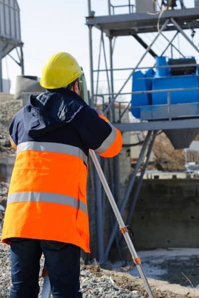
When a licensed surveyor updates your ALTA survey, they can perform what’s known as a “utility locate.” Using modern tools like ground-penetrating radar (GPR) or GPS-based mapping, they trace the full line from meter to foundation. They record exact coordinates and prepare a utility exhibit that can be added to your official property record.
This isn’t just paperwork. It’s protection. It proves what’s on your property, creates a visual record, and ensures you don’t have surprises later if the city, lender, or buyer asks for proof.
The Timeline You Can’t Ignore
Under the EPA’s new Lead and Copper Rule, cities like Dallas must complete their lead service line inventories and confirm materials by 2024. After that, there’s a 10-year window to remove any lead or “unknown” lines.
If your property ends up listed as “unknown,” it can slow down things like remodeling permits, refinancing, or even property sales. Buyers and lenders want assurance that the home’s utilities meet safety standards. That’s where a verified ALTA survey gives you an advantage—it provides a mapped, measurable record of your property’s underground features, including water service lines.
In other words, getting your property fully documented now can save you delays and expenses later.
A Dallas Reality Check
So far, Dallas Water Utilities reports that no lead service lines have been found on the city’s side of the meter. That’s good news. But what’s beneath your yard—the private-side connection—is another story.
Many homes built before the 1980s have limited utility records. Some lines may have been replaced without permits, while others were left undocumented. In older neighborhoods like Oak Cliff, Lakewood, or East Dallas, service materials can vary from one house to the next. For newer suburbs in North Dallas or Richardson, records are clearer but not always complete.
This uncertainty is why surveys matter. They connect your property’s present with its past and prepare it for whatever regulations come next.
A Real Example of How This Helps
Imagine a Dallas homeowner planning to build an addition behind their house. During excavation, they hit an unknown pipe. Without a current ALTA survey, it’s anyone’s guess whether it’s water, gas, or something else. The project halts, inspectors get involved, and costs rise.
Now imagine the same homeowner had updated their ALTA survey. The utility exhibit clearly shows the water line’s path and depth. The contractor knows exactly where to dig safely, and the homeowner has proof for the city’s photo request. No delays, no confusion, no costly surprises.
What You Can Do Next
Start simple. Take the photos requested and submit them. Then, check your property documents. Do you have an ALTA survey that includes utility locations? If not, or if it’s more than a few years old, contact a licensed surveyor in your area. They can perform a quick update that focuses on mapping your water service line, marking it on a current plan, and preparing a digital copy for your records.
You’ll also gain peace of mind. Whether you’re thinking of remodeling, selling, or simply staying compliant, that one update gives you a clear, certified view of what’s beneath your property.
Final Takeaway
This new citywide pipe inspection might feel like another item on your to-do list, but it’s a reminder of something bigger: understanding your property is part of protecting it.
An ALTA survey does more than mark boundaries—it documents the unseen systems that keep your home running safely. By updating your survey now, you’re not just helping the city’s compliance effort. You’re making your property future-ready, easier to maintain, and more valuable when it’s time to sell or renovate.
If you’ve received the notice, don’t stop at the photo upload. Take the next step—map it properly. Book a Service-Line Mapping Visit with a licensed surveyor today. It’s the most accurate, lasting way to keep your home compliant and your investment secure.