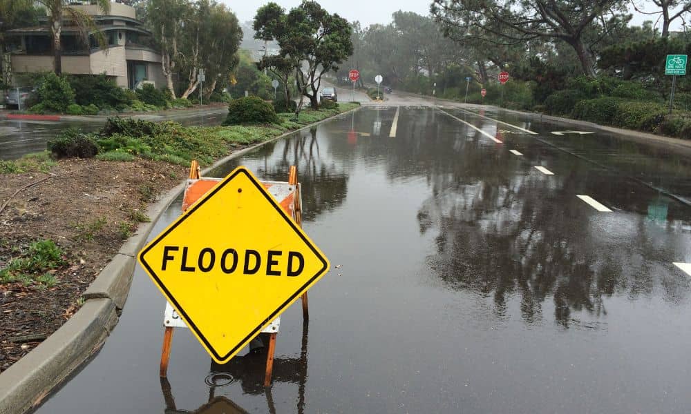
Last weekend’s heavy rain turned Dallas streets into rivers. Videos of cars stuck in water and flooded neighborhoods filled social media. For developers and property owners, those scenes weren’t just shocking—they were a wake-up call. The city’s fast growth and stronger storms are putting pressure on how projects handle drainage design, and it’s clear that the old ways aren’t enough anymore.
The flooding happened just as Texans are voting on Proposition 4, a new plan that could bring up to $1 billion per year for 20 years to fix the state’s water and storm systems. With that money on the table, people are paying attention to how Dallas manages runoff. Developers are realizing that good drainage design isn’t just about passing inspections—it’s about protecting investments and keeping communities safe.
Flooding That Everyone Noticed
In Fort Worth, Irving, and North Dallas, hours of rain pushed drainage systems past their limits. Storm drains overflowed, creeks rose fast, and parking lots filled with water. For homeowners, it was stressful. For builders, it was proof that drainage systems based on old rainfall data can’t handle today’s weather.
Even newer developments had problems. When several inches of rain fall in a short time, the water has nowhere to go. That’s why engineers are pushing for updates to how runoff is measured, stored, and released. Better design can make the difference between a flooded site and a safe one.
Texas Water Fund: A Big Step Forward
The upcoming Texas Water Fund (Proposition 4) could be the biggest change in decades. If approved, it would help cities and water utilities repair, replace, and upgrade their storm and drainage systems. For Dallas, that means more than new pipes—it means designing for stronger, more frequent storms.
The goal is to build resilient systems that protect homes, roads, and businesses, even during record rainfall. Developers who plan ahead could qualify for state funding or low-interest loans once new programs begin. Those who don’t could face higher costs and stricter reviews later.
What’s New in Drainage Design

The biggest change comes from updated rainfall data. The City of Dallas now uses NOAA’s Atlas 14, which shows that rainfall in this region can be up to 25% heavier than older studies suggested. That means bigger pipes, deeper detention ponds, and better grading are now required.
Engineers are also moving away from plain concrete basins. Many new projects use multi-purpose detention ponds—green spaces that store water and look attractive. Some even add underground systems to save space. These designs reduce flooding and improve the overall site.
Another new focus is maintenance. The city wants drainage plans that include access routes, inspection schedules, and clear responsibility for upkeep. This helps prevent failures years after construction. Developers also need early coordination with Dallas Water Utilities (DWU) to avoid conflicts between drainage, sewer, and water lines.
Developers Are Taking Action
Many developers aren’t waiting for new rules—they’re already improving their designs. Some are adding bioswales and porous paving to slow and filter runoff. Others are capturing stormwater for reuse in landscaping. These changes save money over time and make properties more resilient.
Older properties are also being updated. Upgrading or resizing detention ponds can reduce insurance costs and prevent future flood damage. With new state funding on the horizon, early improvements could qualify for financial help down the line.
Civil engineers are now using 3D modeling software that simulates how water moves across a site. This helps find low spots and problem areas before construction begins. It’s a smarter, faster way to design systems that actually work during real storms.
Why It Matters for Every Project
Better drainage design isn’t just about safety—it’s also about speed and approval. The City of Dallas is stricter now with plan reviews. Projects that follow the latest standards and use up-to-date data move through the process faster.
Investors and buyers are paying attention too. Properties that handle heavy rain without flooding are seen as safer and more valuable. For businesses, avoiding downtime means protecting profits. For homeowners, it means peace of mind.
Even tenants care. A well-designed drainage system can make or break a lease, especially for warehouses, stores, and offices that can’t afford flood damage.
Preparing for What’s Next
If you’re planning to build or develop, now is the time to rethink your drainage approach. Before construction starts, check these basics:
- Make sure rainfall data follows Atlas 14 standards.
- Revisit site grading and outflow points.
- Evaluate detention pond size and condition.
- Plan for long-term maintenance and inspections.
Working with a licensed civil engineer early on can save time and money. Engineers familiar with codes know how to design systems that meet both current and upcoming standards.
The Future of Drainage in Dallas
The weekend floods were more than just a news story—they were a turning point. Dallas is moving toward stronger, safer, and smarter stormwater systems. Developers who adapt now will stay ahead of regulations and protect their projects from costly delays.
Every new project, from small commercial lots to major subdivisions, will need a modern drainage design that can handle the storms to come. Those who plan smarter today will be ready when the next big rain hits tomorrow.
If you’re building or upgrading property, this is the moment to act. Good drainage isn’t just good engineering—it’s good business.