If you’ve ever tried to build, remodel, or add a new structure to your property, you probably know how tricky the city’s permit process can be. Between floodplain rules, drainage requirements, and the DallasNow online system, it’s easy to get stuck waiting for approval. One of the biggest reasons for those delays? A poorly scoped topographic survey.
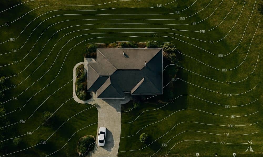
A topographic survey isn’t just another map—it’s the foundation of your entire site plan. It shows every elevation point, contour, and feature of your lot, helping engineers design safe drainage and foundations. When done right, it keeps your permit moving smoothly through Dallas City Hall. When it’s incomplete or outdated, it can stop your project cold.
Why a Topographic Survey Matters So Much in Dallas
Dallas has unique terrain and strict floodplain management rules. Parts of the city lie near creeks or flood-prone areas, especially around the Trinity River and White Rock Creek. That means a single inch of elevation can decide whether your project passes review—or triggers another round of revisions.
A topographic survey captures your lot’s slopes, high and low points, trees, driveways, retaining walls, and drainage paths. Engineers use this data to design grading plans that keep water away from your home and prevent flooding on neighboring lots. The city’s reviewers then use those same contours to check compliance with stormwater regulations.
So, when your survey is missing elevation data, shows old contours, or doesn’t include nearby structures, reviewers flag it as “incomplete.” Suddenly, your builder can’t pour concrete, and your project is delayed by weeks.
Start Smart: Pre-Screen the Lot Before You Survey
Before hiring a surveyor, do a quick 30-minute pre-check. This step alone can save you time and money later.
First, visit FEMA’s National Flood Hazard Layer (NFHL) online map. Type your property address and see if your lot falls within Zone AE, AO, or any other flood-risk zone. If it does, your survey will need additional elevation shots and possibly a flood elevation certificate.
Next, go to DallasNow, the city’s GIS-based permitting system. This platform lets you view floodplain boundaries, drainage easements, utilities, and even prior building permits. Look for overlapping easements or existing drainage channels that could affect your design. If you spot potential issues, share them with your surveyor before the work begins.
These two free tools—FEMA NFHL and DallasNow—give you a clear picture of what the city already knows about your property. They help you define the right scope for your topographic survey, rather than paying for a second one later.
How to Scope a Topographic Survey the Right Way

Every property is different, so no two surveys are identical. Still, a good surveyor will include these essentials:
1. Complete Elevation Coverage. Your survey should capture elevation data across the entire lot, including driveways, patios, and backyards. Even small grade changes can affect drainage. If your lot borders a floodplain, make sure the survey includes Base Flood Elevation (BFE) points from FEMA maps.
2. Visible Utility Features. Dallas inspectors often reject plans that don’t show visible utility markers like manholes, water meters, or power boxes. These features help engineers verify setbacks and plan service connections.
3. Drainage Flow Directions. Contour lines should clearly show which way water flows across your property. The city wants proof that stormwater won’t drain onto a neighbor’s lot.
4. Nearby Structures and Roads. If your home sits close to another property, your survey should include a few feet beyond your boundary. That extra detail helps confirm grading transitions and easement compliance.
5. Benchmark Tied to City Datum. Ask your surveyor to tie the elevations to the City of Dallas benchmark system. This allows engineers and reviewers to cross-check data easily without conversion errors.
Connecting Your Survey to the DallasNow System
DallasNow has modernized how the city reviews building permits. The system accepts multi-page PDFs and layers from your surveyor or engineer, but it’s strict about formatting.
When you upload your topographic survey, label the file clearly—something like “Site_TopoSurvey_[address]_RevA.pdf.” If your file name doesn’t match the project address, the reviewer may miss it in the queue.
DallasNow also performs automated checks for missing data. If your contour lines are faint or mislabeled, the file could fail the quality scan. Reviewers will then mark it as “Incomplete Application.” That’s why it’s important to make sure your survey includes high-resolution contour layers and a legible legend.
And here’s a bonus tip: the city occasionally schedules maintenance downtime for DallasNow. Always aim to submit your plans one or two days before those dates so your application isn’t stuck in digital limbo.
Common Mistakes That Cause Permit Delays
Even experienced builders make avoidable errors when it comes to topographic surveys. Here are the biggest ones:
- Submitting a survey that’s more than six months old. Terrain changes quickly, especially on active construction sites.
- Forgetting to include nearby street or curb elevations.
- Leaving out existing fences or retaining walls that affect drainage.
- Failing to tie elevations to the city benchmark system.
- Uploading low-resolution scans that DallasNow can’t process.
Each of these mistakes might seem small, but together they can trigger weeks of back-and-forth communication with city reviewers.
How a Good Survey Helps Your Entire Team
A detailed, current topographic survey doesn’t just please city officials—it helps your whole project run smoother. Civil engineers use it to design safe grading and stormwater systems. Architects rely on it to plan foundations and retaining walls. Even landscapers use it to shape final contours.
When everyone works from the same accurate survey, you avoid conflicts later on. Your contractor won’t have to re-grade the site, and your project is more likely to finish on schedule.
For homeowners, that means fewer surprises, fewer change orders, and less stress.
Final Thoughts:
Dallas is growing fast, and with growth comes tighter regulation. The good news? You can stay ahead of it. By scoping your topographic survey carefully—using FEMA and DallasNow as your guides—you can spot flood and drainage issues before they stall your permit.
Think of it as a small investment for peace of mind. A licensed land surveyor who understands the city’s systems can help you collect the right data the first time. That means faster approvals, smoother construction, and one less reason to worry when you hit “submit” on your application.